Monday, May 10, 2010

Cathedral Wash to the Colorado River, Arizona


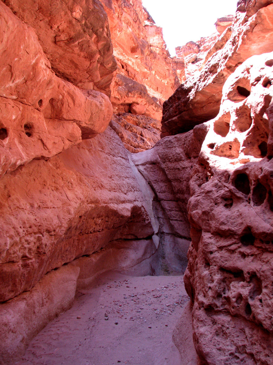
--> From Glen Canyon Dam the Colorado River cuts its swath through the Vermillion Cliffs. Several miles upriver from the head of Marble Canyon and 14 miles downstream from the Dam is Lee's Ferry. In 1872 John D. Lee established a ferry at the confluence of the Colorado and Paria rivers, the only safe crossing of the Colorado River in 700 miles. Several miles southwest of Lee's Ferry is Cathedral Wash. A wash is a watercourse that only flows during rain. This one runs from the plateau on the north side of the Colorado river down to the river. The hike is only about a mile and a quarter to the river, but it's a dry sandy was with frequent scrambles on the sandstone to get around pour offs (drop offs where the waterflows over a waterfall – difficult to hike). The infrequent flow through the wash has still managed, after who knows how many million years to wear it's way deep into the sandstone forming a canyon with high sides that twists and turns it's way down to the river. We're going down the wash, into the Grand Canyon to the Colorado River. Behind us are the Vermilion Cliffs.
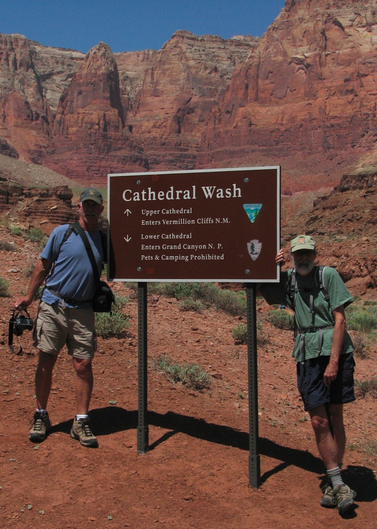
03 Cathedral Wash hike Ted and Whazoo
We will be traveling back in geological time through the Kaibab Limestone and Toroweap Formations that are seen in the Grand Canyon. Any time you hike in this area you are looking at a snapshot in time because these creeks and rivers have gouged their way down through layers of rock that were deposited millions of years ago. We met a geologist on the bus at the south rim last year and he was like a little kid with a new toy explaining the sandstone / limestone layers to us. This is considered a moderately difficult hike, not due to the length or elevation gain, but due to the ruggedness of the terrain. 
Oh! By the way we dropped by the BLM office for the lottery. No Go again today. Third try. ☹☹☹
02 prince s plume in the wash
Like most canyon hikes this one started with a walk in the open down a sandy wash. This is where we look for wildlife and this time we were lucky.
04 horned lizard
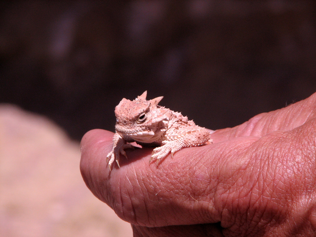
We spotted a horned lizard, the first one we had seen.
04a posing lizard
They are tiny little things, and that's good. I would hate to face one if they were 4 feet long. Like so many things in the desert, they look very defensive.

Lots of Taffoni in the rock here. I'm not sure what has caused it, comments anyone? I'll try to look it up and post later.
06 odd rocks
Speaking of looking things up, Julie Ligon sent me some information about Rabbits and Hares from an earlier post. I'll add it at the end of this letter. *
01 heading down the wash

--> This is the Kaibab Limestone. It's brittle, fragile, and riddled with fossils. I'd love to tell you that we found some fossilized dinosaur bones, but most is unrecognizable except to an expert. You do see an occasional shell though. You have to be careful walking on this stuff because it fractures so easily that it is easy to turn an ankle on it.


--> A short while down the trail the canyon begins to narrow as the walls get higher. Unlike Buckskin Gulch this canyon never gets too narrow and is generally a couple of hundred feet or more wide.
22 rounding the bend
07 heading downAs we go deeper into the layers, the trail gets tougher.
19 long drop
--> At this point we also started running into impassable pour-offs and had to climb the walls for a while to get around them.
08 whazoo
25 duck down
--> 
20 carved overflow

21 aftenoon sun The last half mile or so got very rough and narrow, but then started to open up as we got closer to the river. At this point we could hear the river in the distance. 
24 good camo
Another canyon visitor heading for the river.
14 looking up canyon
The Colorado River: Looking up canyon.
13 the mighty Colorado

--> The mighty Colorado River.  Here at the beginning of it's journey through the Grand Canyon the river is clear and has not yet picked up it's distinctive red color. I guess it has left most of it's silt behind the dam. Seems as though I remember that they have had to take ameliorative action over the last few years, increasing the outflow from the dam, because of silting problems in the Canyon due to low flow; probably going to have them behind the dam sometime too.
16 looking down canyon
23 OOH that s cold
Oh!  That water is very cold.
15 the canyon rats
-->
Good lunch spot. We got here by the only way you can, walking...sure keeps the crowds away.

17 heading up canyon

--> The Colorado River is one of those special places that we are privileged to have in our world and it was exciting to see it here. It may be tamed somewhat by dams, but it's still a wild and scenic river and a joy to see. Time to head back up Canyon. Why do these canyon hikes always have to end going uphill. I'm going back to the mountains where the hikes are right side up.
28 up the double yellow
Tired hiker on the home stretch. Notice how heavy the traffic is. We seem to have a knack for going places that are out of the way, and/or off-season and that suits us fine. We often find ourselves the only people at a campground and seldom meet more than a few, if any, people on the trail. Whazoo and Lynn need to get back home tomorrow so Cheryl and I will continue exploring the Paria River area on our own and I'll tell you a little bit about our lifestyle on the road. We'll try for “The Wave” again too. If third time isn't a charm, what's fourth time?

* What is the difference between a hare and a rabbit?  This is a very good question because most people often confuse rabbits and hares, but they are very different in several ways. Hares are generally larger, and have longer hind legs and longer ears than rabbits. When hares are born, they have a full coat of fur and their eyes are open. Their mothers either drop them on the bare ground at birth or into a slight depression in the ground. A young hare is called a leveret. Rabbits, on the other hand, are more compact. Their young, called bunnies, are born hairless and blind. The mother rabbit lines a nest with grass, bark and soft stems. Over this, she places a layer of hair that she plucks from her own body. When she leaves the nest, she covers the bunnies with more hair and dead plants to keep them warm and hidden from enemies. Rabbits and hares both molt and then grow new hair. This happens in both the spring and in the fall. Rabbits' brown summer fur is replaced with fur that is grayer. Hares, especially those living in cold, snowy regions, turn white in the winter. Rabbits and hares are more active during the dark hours from dawn to dusk. Rabbits hide in either burrows or depressions in the ground during daylight hours. They try to keep hidden. Hares hide among plants and usually try to escape enemies by running. Rabbits are often found together. Male rabbits even fight within a group to become the dominant male. The dominant male rabbit then mates with most of the females in the area. Hares live most of the time by themselves. They come together in pairs for mating only. There is little or no fighting among hares. They just pair off. The link below provided the information on rabbits and hares. Thanks to Julie Ligon for the info.
Next:  A little free time in southern Utah.

Sunday, May 9, 2010

Buckskin Gulch, UT

First let me tell you about “The Wave”. The Wave is world famous and people come from all over the world to hike it. The Wave is so fragile that the BLM only allows 20 people a day to hike into Coyote Buttes (the general area) and the Wave (a specific feature in the area). 10 people are drawn from an internet lottery held 4 months in advance of the permit date, and 10 people are drawn the day before the permit date from the 80+ that show up at the BLM Paria office. This is our second day applying. The odds are not good, but we applied with hope in our hearts... Not today. ☹☹ The BLM is so strict that if 9 have been drawn and a permit for two is drawn next, only one can go. 10 people – absolute limit. We're going to stick around for a couple of days to try and win the lottery.

Second, a “Gulch” is a canyon, and it generally tends to refer to the more steep sided river carved canyons.  Hackberry was a canyon, but almost a gulch. Who knows. Buckskin Gulch is the longest, tightest, and deepest slot canyon in the world. It runs from the head of the canyon on House Rocks road to the Paria River. A slot canyon is one so narrow and so deep that you sometimes have to remove your pack and turn sideways to slip through. Water roars through these canyons during times of rain and can turn them into an instant death trap. Often storms many miles away will send a wall of water rushing through the canyon.
 This is a slot canyon.
It is hard to describe what it is like to be in one of these canyons. They are amazingly beautiful, fun to hike, and just a little scary. Fortunately for us, no recent rain, and none predicted, so the fear of flash floods was pretty much non-existent. The fun and beauty...Lots of it. I'm not going to tell you how many pictures we took, but we're into the many hundreds (just on this hike). I'll let the pictures speak for themselves.
The entry into Buckskin Gulch is from the Wire Pass trailhead. It starts with a wander down a typical canyon wash. We are fortunate to be here at this time of year when the temperatures are still cool and the desert flowers are blooming.


The canyons were alive with Indian Paintbrush, dotting the sage hillsides with bright red splashes.


About a mile down the Wire Pass Trail the walls start to close in on the canyon, then suddenly around a corner the canyon drops into a narrrow opening and disappears. For the next 12 miles, until you get all the way to the Paria River, there is no escape from this narrow canyon but to turn around and hike back the way you came in. The walls are sheer rock 3 to 15 feet apart and, after the first quarter mile, 200 to 400 feet high. It's a very spooky, yet exhilarating place.
The Wire Pass Trail actually connects with the 15 mile Buckskin Gulch at it's 4 mile point, and as I said, from this point on you are in it.  This junction is one of the few places where the canyon widens enough to get a clear view of the sky.


The canyon walls vary in color from a deep maroon to red, orange, and at times yellow, constantly changing with the sun. We had a beautiful blue sky day and the sunlight played on the walls throughout the middle of the day. We wondered what it would be like to hike the canyon in a full moon. Creepy I'm sure.


From this point, until we turned back about 4 miles down canyon we never saw more than a few feet of the sky high above our heads.


Our intrepid and fun loving guides Whazoo (Dave) and Lynn. Whazoo and Lynn travel around the southwest searching out extreme and unusual adventures...They know all the good places and we are very fortunate that they have chosen to share some of them with us.


Dave regularly posts pictures and text about his adventures on an internet forum. Go to WWW.RV.NET, select the truck camper section and do a search for “Whazoo”. You will be amazed. His trip reports are informative and funny.


You can see in these shots that a little sunlight is filtering down, but the walls are very close here.
They are usually very smooth and sculptured in sinuous curves.
Millions of years of sand laden water can do a lot of work. The floor of the canyon is relatively flat which makes me wonder just how deep the sand under our feet is.


This debris pile, the bottom of which is lodged 30 feet above our heads, will give you some idea of what a flash flood in a slot canyon might be like.

We kept playing Peek-A-Boo with each other, and bouncing echos around the corners. Somehow we timed it very well and only ran into about 8 or 10 other hikers in the 4 or so hours we were in the gulch.


Sunlight on Stone


The picture at left is in the Wire Pass Trail just after entering the slot. As you can see the walls are somewhat lower here prior to the junction with Buckskin Gulch.


Want to guess how that stick got up there?


Our heartfelt thanks to Dave and Lynn. This is the second year they have seen fit to shephard us around the southwest in search of amazing adventures. They're the best.


Special thanks to Cheryl whose photographic skills are what makes these reports so good. Cameras: Canon S3-IS & Canon Rebel XSI


Next: Dave takes us to the Colorado River...The hard way: Cathedral Wash.

Thursday, May 6, 2010

Paria River Area, Utah

The Arizona Strip is that area of Arizona that lies north of the Grand Canyon and south of the Utah border.  Most of the area, including parts of southern Utah are under the aegis of the BLM (Bureau of Land Managment).  This area is a wonderland of geological oddities and a joy to explore.  We know of a small dispersed campsite in Utah, a mile or so north of the strip.  That is our destination.  From Honeycomb Rocks, after a stop in Cedar City, UT for supplies we roamed south through northern Arizona then up the Cane Bed road to the BLM section of Coral Pink Sand Dunes.  There is also a Coral Pink Sand Dunes State Park, but it is an offroad haven and we were looking for a bit of quiet.
We found a neat BLM campground with access to the dunes.  Coral Pink just doesn't do it for me, I think they are just coral colored, a sort of orange, but it is quite a sight to see sand dunes in the middle of a ponderosa forest.
It appears that the near constant wind is eroding the red rock that is prevalent in the area into coral colored sand dunes which are gradually taking over the forest.


We stayed one night, hiked into the sand dunes the next morning (tough hiking).  We drove into Kanab for the day to get some information from the BLM office about Paria Canyon (didn't get much), dump our tanks and fill up with water. North of Kanab we found a nice dispersed camping area in the Ponderosa forest, had a pizza, and went to bed.

Next morning we were up bright and early and drove east into the Paria River area just west of Lake Powell. I'm using the term Paria River area loosely here. The Paria River drains a vast area of the Escalante - Grand Staircase National Monument and flows southerly, midway between Lake Powell and Kanab, into the Colorado River at Lee's Crossing. It does indeed have a canyon, but we are essentially referring to this vast area between Lake Powell and Kanab as the Paria River area.  As you shall see, this is an area of astounding beauty with many unique features. Paria is pronounced par ee' ah.  We were planning on meeting our friends Whazoo and Lynn at the Lone Rock Campground on Lake Powell in 2 days. We stopped at the BLM contact office for Paria Canyon and met Emily, a lovely volunteer who gave us two great campsites in the dispersed camping area.

So we drove down House Rocks Road ( 4 miles of washboard gravel) to a site at the foot of Kaibab Gulch.  Kaibab Gulch is a primarily white sandstone canyon that feeds into the red sandstone Buckskin Gulch. The gulch is referred to by Emily's husband Bill as “Naked Canyon”, because you will never see anyone else there (we can attest to this). I'll leave the “Naked” part to your imagination...Bill is in his 70s. We hiked the gulch for about 3 miles and found it to be interesting, not really a slot canyon, but pretty and full of fossils.
Looking up Kaibab Canyon from the back door of the camper.
The campsite was as quiet and dark as you could ever want and the nighttime sky was awesome.

The next day we drove back up to the BLM office to get information on local hikes and moved the camper to the other recommended spot, a little closer to highway 89 for easier access.
We called our friends and re-arranged the meeting spot to the dispersed camping area.
Emily recommended we apply the next morning for a permit to “The Wave” and gave us a list of hikes we might like.

We selected Hackberry Canyon in the Grand Staircase - Escalante National Monument...our first slot canyon.
Hackberry Canyon.
Hackberry Canyon is 14 miles up Cottonwood Road. When in NH we live on a dirt road. Utah gravel roads are different. 14 miles of twisty, rocky, rough, washboard, road that took over 50 minutes to drive.
Cottonwood Canyon Road.
According to the status sheet it had recently been graded. I gave it a C-. The canyon, however, was worth it.


Hackberry Canyon, carved over many many years by Hackberry Creek, is what you might call a wet hike.


Water flows in the creek bed, which is also the trail, for most of the year, but it is shallow and warm at this time of year so it wasn't a problem.


The hike is about 2 miles long in the canyon and is one of the prettiest hikes we had ever done.


The southwest is a geological wonderland.  Millions of years of sedimentation, compression, and uplift, have created colors and textures of rock, that defy the imagination.  I know I have said before, but I must repeat myself, that Cheryl's pictures, marvelous though they are, cannot begin to capture the true beauty of this area.  You should find a way to visit the Colorado Plateau and find some of these places.  Take your own pictures and see for yourself what we so inadequately describe.
Canyon Walls at Sunset.
The color of the sandstone in the afternoon sun is incredible.  Finally, the sun was getting low and it was time to leave the canyon. 50 minutes and 14 miles later, we hit route 89 and headed for home. Whazoo and Lynn arrived the next day and we had a joyous reunion, then made plans to apply for a permit for "The Wave" and to hike into Buckskin Gulch the following day.
Hook 'Em
Our Daily Song.


Our neighbors.


⇑    The view from our campsite.  Not too shabby, eh?   ⇒


More on Buckskin Gulch, the Colorado River, and “The Wave” to come.