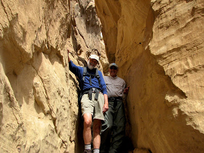
 Bandelier National Monument is located in North Central New Mexico, between Los Alamos and Santa Fe in a rugged high desert at 6,500 feet. This altitude gives Bandelier a pleasant climate with warm spring days and cold nights. Bandelier, similar to Chaco Culture NHP, is a site of ancient great houses, but unlike Chaco there are cliff dwellings and cave dwellings as well. Bandelier is also a marvelous park for hiking.
 Our first day at Bandelier, on our way to an 8 mile hike to the Rio Grande River we stopped at the visitor center to observe a Native American Dance celebrating the presence of the Deer in their lives. The Dance and Drumming was very interesting, and the workmanship of the clothing worn by the dancers was exquisite.
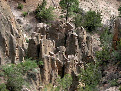 The hike took us past a group of "Tent Rocks" which are volcanic tuff capped by harder rocks. As the volcanic rock wears away the harder caps protect the tuff underneath forming various spires,needles, and hoodoos.
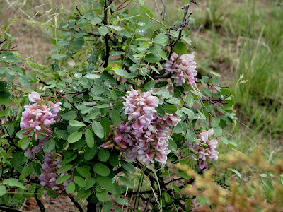
 The hike took us past many wildflowers as we wound our way down several thousand feet to the floodplain of the Rio Grande.
 One of the high points of this trip has been the opportunity to see many of the great rivers of our country. I can remember many years ago, in grade school, reading about these rivers that were so much a part of our history and development as a nation. I was always fascinated by them.
 Living in New England I often visited the Concord, the Merrimack, and the Connecticut rivers, but I have only recently begun to explore the great rivers of the west. I never pass up a chance to swim, or at least wade, in these rivers.
 We were fortunate on this part of the trip to have our friend Linda Regnier, Author of Best Easy Day Hikes, Santa Fe with us as guide. We did three of her hikes during our stay and if you are going to Santa Fe I can heartily recommend this book. Linda dropped by the bookstore to sign a few copies.
 We vistited some of the cave dwellings with Linda and her husband Jim after our Rio Grande hike.
 The day after Jim and Linda left for another commitment Cheryl and I headed out for a hike up Frijoles Canyon which is the main canyon containing much of the National Monument.
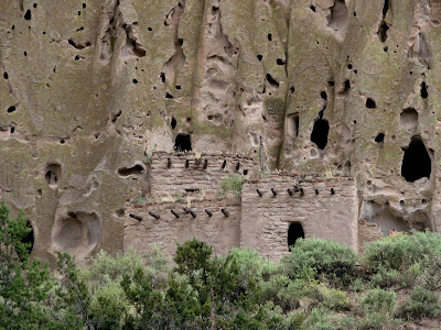
 The unrestored Great House is in Frijoles Canyon as well as the Long House.
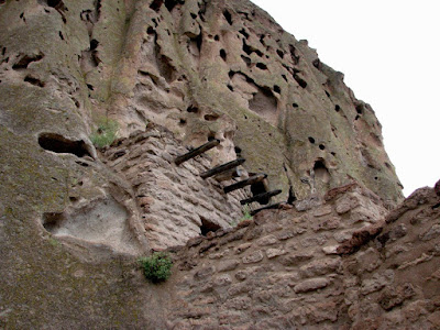
 The Long House is essentially a long narrow Great House built on the ground against a high cliff with many excavated cave rooms adjoining it. We also went to the Ceremonial Cave.
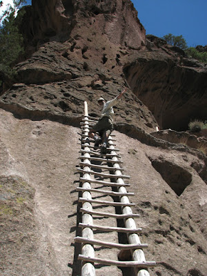 We accessed the Ceremonial Cave by a series of 4 very long, very steep, wooden ladders.
 There is a reproduction Kiva in the cave and it was cool, after seeing so many ancient Kivas, to be able to enter the Kiva.
 On another day we drove up to the rim of the Valle Caldera National Preserve and hiked down through the ponderosa forest lining the inside of the rim to the Caldera floor.
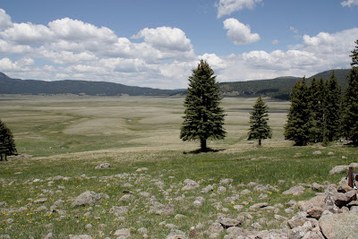 The floor of the caldera is a huge meadow sitting in a bowl ringed by low mountains. The mountains are the eroded rim of what was once a vast volcanic cone. Can you imagine it?
After the hike to the caldera we found a little used trail head to the boundary area between Valle Caldera and Bandelier National Monument.
 We found the usual wildflowers (isn't it wonderful that such things are "Usual" on this trip). These are Western Blue Flags, a small wild iris. They are often referred to by their state's name so I guess these would be New Mexico Blue Flags.
  The trail passed through a series of lovely meadows that once again led up to the Caldera Rim. As so often happens the naked beauty of this remote area drew us into a much longer hike than we had anticipated.
  Two hikes in one day and we barely had time to make it back for supper with our friends Ian and Jenny from Vermont who came to Bandelier as a stop on the maiden voyage of their new camper which they had just picked up in Chilliwack, British Columbia.
 On our final day at Bandelier we took a trip into Santa Fe to see the sights.
 It was interesting to compare the architecture of present day Santa Fe with the ancient buildings we had been viewing in Bandelier.
 Santa Fe is a marvelous city. Like many such places in the county, development and traffic are taking a toll on these historic and beautiful places, but if you can find the "Old Town" you will be richly rewarded.
NEXT: We head north to visit Telluride, Colorado and Dinosaur National Monument.


